A day in the southeast of Hamburg.
opencanoe.blogspot.com on a larger map
 Length: (pauses to two hours)
11 hours.
trail:
38 km
Difficulty:
easy. note on and water running in the airlock of the boat leave
Tour: Start at the Dove-Elbe, about the exploits Berger lock in the same, with the tide upriver to Deicher High altitude lake. Down the river Elbe at the Tatenberg lock over by the barrage Billwerder Bay, on the timber port by the low stack lock in the bill.
 to joining you paddle through the wooden bridge, to the right is the training center for rowing to the left a nice, in 2008, little-visited place to swim at the small wooden tower. It is used for racing the judges. After the turn of the Goose - Elbe, keep to the right Tatenberg towards lock.
 locks at the same costs nothing, the same for a human-powered sport boats 1.60 - 3.00 EUR.
The opening times of Tatenberg lock: from 1.5. - 30.9. Daily from 6.30 am - 20.00 clock, and Sunday and public holidays and the day before Sunday and holidays from 6.30 - 21.00 clock of 1.10. - 30.4: daily from 6.30 am - 18.30 clock opening outside normal operating time. The plant is operated outside the specified operating time when the vehicle is registered no later than half an hour before closing time at the lock. Registration: Phone: 040 / 780 87 61-0.
for paddling on the River Elbe, one should first learn about the tides . Against the tidal current, the paddling is hardly possible since the flow rate of the same close to the average paddling speed is, we place "on the spot" plowing.
 reach at the same current one turns to the Tidestrom Elbe upstream. One should reach at flooding tide (ie, after low water and flood), the River Elbe.
 opens to the right soon Georgswerder Schleusengraben ( N53 30 11.3 E10 03 12.4 ) before the extension Wilhelm Burger Dove-Elbe. A nice place for a rest and the exit to the portage to Wilhelmsburg the Ernst-August channel. It should be on the Elbe near the shore and keep cross the fairway only directly and quickly. Larger vessels generate waves which can take more from the front.
 It happens sometimes on the upstream left side of the river at N53 28 04.0 E10 03 52.6 a possible exit to the Dove - Elbe, which can be reached from there with a boat trailer with a little walk of about three quarters of an hour. This can be useful if it no longer acts down the river Elbe tide-lock Berger creates.
 After passing through the small stack master port flow together to reach the top colored houses in the Northern and Southern Elbe (the Süderelbe down it would go over to the port of Hamburg the Elbe islands). This takes the ship to transport something.
 Man on Elbe upstream paddle to turn the tide. Usually one creates the port still Oortkaten and the little "house on stilts" in the amount of Oortkaten lake. With the reversal of the flow - direction near high water and used to paddle with the now running water back down the river Elbe.
 After the turnoff to Tatenberg lock after the highway bridge, is on the right bank down the Elbe Kaltenhof. On the Elbe island was formerly Elbe water processed later groundwater to drinking water.
starboard soon opens the entrance to the barrage Billwerder bay and the timber port. Here is a busy barge load usually bulk.
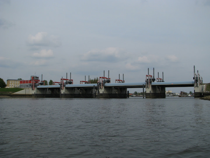


When approaching the lock Tiefstack is important to pay attention to the commercial shipping. If the lock chamber is open and the green signal light can enter directly. always behind the motor boats remain. On entering the Hamburg sewer system you have to pay for the smuggling. At least now in the payment of the lock chamber out one looks forward, that no one drives kayak increases simplifies the ladder, climb up and goes to lock-keepers - house where you pay for. One gets the boot before hard cover, you can also enter again.
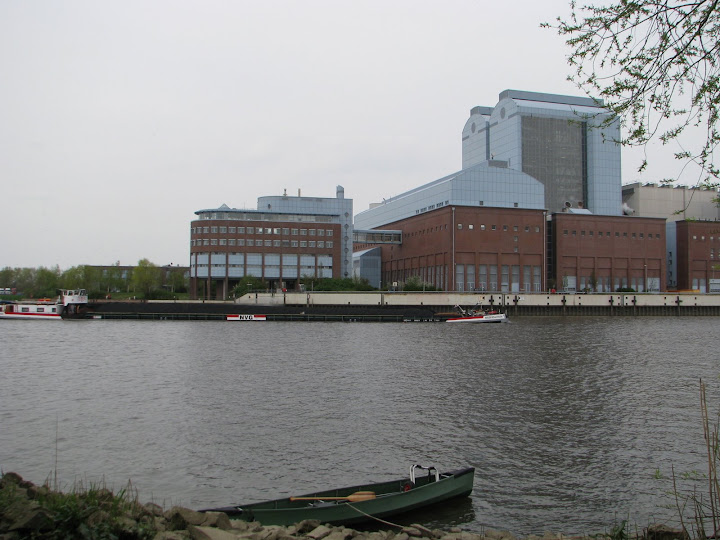
 Behind the gate you pass first the power plant stack depth and the local MVA. Again, there are inward at the city the right bank an opportunity to break.
 you paddle through the bridges and over the intersecting channels straight until it stops and then keep to the starboard.
 Slowly converts the image of industrial canal toward the wilderness. Sometimes we can even see deer.
 On Steinbeck inflow crosses the highway. Behind it is a small gate with portage-way. The end of the tour.
Here the track record of the entire tour at a glance.
larger map with photos The track was recorded with a Garmin eTrex GPS unit and converted into a KMZ file


